
File:Map of German troop disposition around Saint-Quentin on 22 April 1917.jpg

Size of this preview: 749 × 599 pixels. Other resolutions: 300 × 240 pixels | 600 × 480 pixels | 960 × 768 pixels | 1,280 × 1,024 pixels | 2,560 × 2,048 pixels | 2,951 × 2,361 pixels.
Original file (2,951 × 2,361 pixels, file size: 4.25 MB, MIME type: image/jpeg)
| This is a file from the Wikimedia Commons. Information from its description page there is shown below. Commons is a freely licensed media file repository. You can help. |
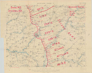
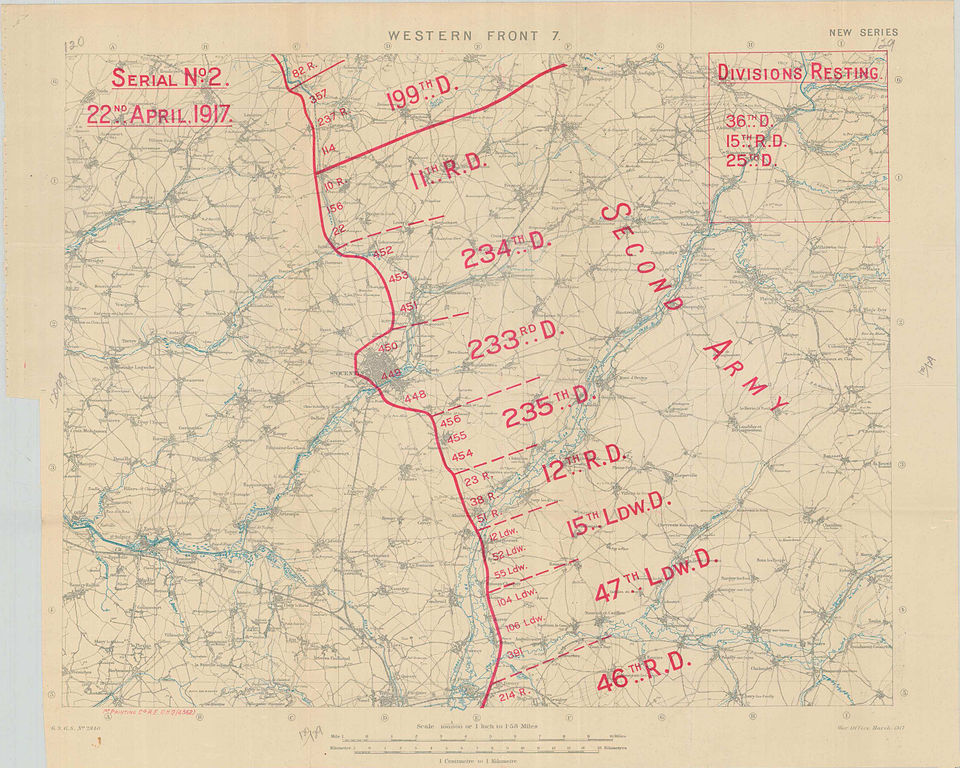
| Description | Disposition of German troops on 22 April 1917, between La Fere and Gouy. Focus is placed on Saint-Quentin. |
| Date | |
| Source |
Excerpt from Australian War Memorial (www.awm.gov.au) War diary awm4-1-30-15 part3, page 28 |
| Author | Field Survey Company, Royal Engineers |
This image is protected by Crown Copyright because it is owned by the Australian Government or that of the states or territories, and is in the public domain because it was created or published prior to 1974 and the copyright has therefore expired. The government of Australia has declared that the expiration of Crown Copyrights applies worldwide. This has been confirmed by correspondence received by the Volunteer Response Team (Ticket:2017062010010417).
|
 |
This work is an Ordnance Survey map over 50 years old, which is covered by Crown Copyright which in this case expires 50 years after publication. Ordnance Survey does however ask that they be credited and that the date of publication be given.
Any ancillary rights gained through the creation of the electronic version are granted as freely usable under any circumstances.
|
This work created by the United Kingdom Government is in the public domain.
This is because it is one of the following:
HMSO has declared that the expiry of Crown Copyrights applies worldwide (ref: HMSO Email Reply)
|
 |
File history
Click on a date/time to view the file as it appeared at that time.
| Date/Time | Thumbnail | Dimensions | User | Comment | |
|---|---|---|---|---|---|
| current | 16:56, 19 August 2012 | | 2,951 × 2,361 (4.25 MB) | Labattblueboy | {{Information |Description= Disposition of German troops on 22 April 1917, between La Fere and Gouy. Focus is placed on Saint-Quentin. |Source=Exerpt from Australian War Memorial (www.awm.gov.au)<br>War diary awm4-1-30-15 part3, page 28 |Date= April 1... |
File usage
The following pages on the English Wikipedia use this file (pages on other projects are not listed):