
Uploads by StefenTower
This special page shows all files uploaded to the English Wikipedia. (See also the list for Wikimedia Commons.) By default, the last uploaded files are shown at top of the list, but clicking on a column header will change the sorting.
Deleted files are not shown here but are included in the upload log.
| Date | Name | Thumbnail | Size | Description |
|---|---|---|---|---|
| 18:14, 17 June 2009 | EdHamilton2009.jpg (file) |  |
23 KB | Ed Hamilton at the June 2009 Lincoln Statue Dedication at Louisville Waterfront Park. This is a cropped still from a video that I took during the event. |
| 18:48, 17 November 2008 | NestedBannerMetaExample.jpg (file) | 25 KB | Image I snapped from a Wikipedia page for use in discussion. | |
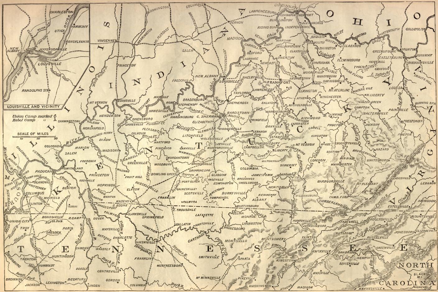
| 00:05, 6 August 2007 | Harpers-CivilWar-kentucky-battle-map.jpg (file) |  |
359 KB | Printed in Harper's Weekly October 19, 1861. [http://www.sonofthesouth.net/leefoundation/civil-war/1861/october/kentucky-battle-map.htm Source] |
| 21:24, 15 January 2007 | LouisvilleMetroArea.png (file) |  |
6 KB | I created this image using Image:Map_of_USA_with_county_outlines.png. |
| 23:41, 24 August 2006 | Fleur-de-lis-3d.jpg (file) |  |
24 KB | Image based on Image:Fleur-de-lis-3d.png, which is in public domain. I converted it to jpeg, and gave it a background. I release my changes into the public domain. |
| 00:12, 23 August 2006 | ViewFromMoroRock.jpg (file) |  |
87 KB | View from Moro Rock. Taken by me. |
| 04:54, 29 July 2006 | LouisvilleCSA-Census04.jpg (file) |  |
78 KB | This is a representation of the Louisville-Elizabethtown-Scottsburg, KY-IN Combined Statistical Area. I created this image using a U.S. Census Bureau map image from [http://www.census.gov/geo/www/maps/msa_maps2004/us_wall_1104.htm Metropolitan and Mi |