
User:Sanaaglander
THE PROBLEM SOOL,SANAAG&BUHOODLE AND THIS MAP[edit]
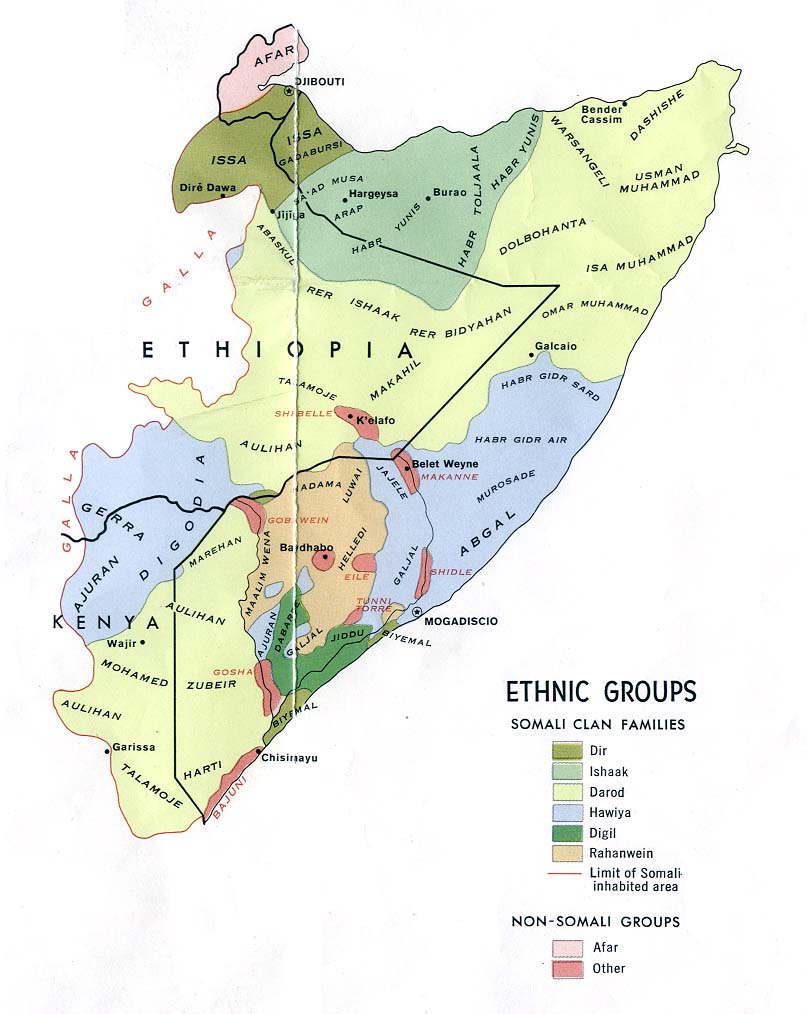
this map must be basis the somali clan families map because that part of somalia unlike other parts of somalia so be becarefull that is reason of the confilict and this intersection lines must be cover all harti area in sool,sanaag and cayn using tha map of somali clan families :
- [lib.utexas]
- this correct and usefull map of harti part in former british [economist]
there are area excepted in this map the lines extended in the conflict area between puntland and somaliland {ceerigaabo(arigavo) district}Include :masagan,ceelaqoday,madare,ardaa,dhaxamo,biyoguduud,jiidali,fiqi fuleye,awrboogays,dhaabeeda,ceelqoxle ,xingalool,damalaxagare,yube,carmale,bir xamar,dabablehe look map of ceerigaabo:
- [fallingrain] that mean that area is inhabitants by isaq clan or belong them but that is not true it is big mistake to refer area for one clan to other clan.reason of conflict is distribute of the tribes if you look map of somali clan families you see:
the puntland need to make darod state look map of puntland: [puntlandgovt ] include all area inhabitants by harti clan,
where somaliland need to make isaaq nation in the boundaries of the new republic are the same as those of "British Somaliland [somalilandgov] that is impossible because who inhabit the regions of Sool, Sanaag and Cayn (approximating over 40 percent of the geographical area of the so-called Somaliland), as members of major Somali clans.
the problem is the people of Sool and Sanaag, as members of major Somali clans, have recognized borders. It is a well defined border, with longitude and latitude; it is borders well recognized by Her Majesty, the British Kingdom; it is a border that recognizes where the Isaq sub-clans reside and where the Harti sub-clans are too. I'm tellin the owner of this map don't disturb those borders and the peace.